Beauty at its Best

Beauty at its Best

Monday, August 22, 2011

HUNZA VALLEY

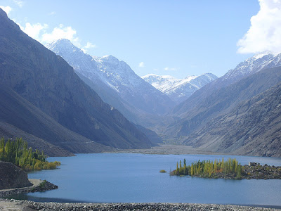
The Hunza Valley is a mountainous valley in Gilgit in the Gilgit-Baltistan autonomous region, an area under the control of the government of Pakistan. The Hunza valley is situated to the north of the Hunza River, at an elevation of around 2,500 metres (8,200 ft). The territory of Hunza is about 7,900 square kilometres (3,100 sq mi). Karimabad (formerly called Baltit) is the main town, which is also a very popular tourist destination because of the spectacular scenery of the surrounding mountains like Ultar Sar, Rakaposhi, Bojahagur Duanasir II, Ghenta Peak, Hunza Peak, Diran Peak and Bublimating (Ladyfinger Peak), all 6,000 metres (19,685 ft) or higher.


The visitors to Hunza are overwhelmed by the rugged charm, the fragrant breeze singing through graceful Poplar trees and the velvet-like green carpet of wheat fields, set against the background of snow-covered mountains.

Hunza Valley's tourist season is from April to October. The temperature in May is maximum 27 C and minimum 14 C. The October temperature are: maximum 10 C and minimum 0 C. However, one can visit Hunza round the year.

Most of the people of Hunza are Ismaili Muslims, followers of His Highness the Aga Khan. The local language is Brushuski. Urdu and English are also understood by most of people.

Karimabad, the capital of Hunza, offers an awe-inspiring view of Rakaposhi 7,788 metres. The snows of Rakaposhi glitter in the moonlight, producing an atmosphere at once ethereal and sublime.

The fairy-tale like castle of Baltit, above Karimabad, is a Hunza landmark built about 600 years ago. Stilted on massive legs, its wooden bay windows look out over the valley. Originally, it was used as the residence of the Mirs (the title of the former rulers) of Hunza.

Mountaineering And Hiking
Hunza is ideal for mountaineering, trekking and hiking. Most of the treks in Hunza area are in open zone, for which tourists do not need any permit. However special permits are required from the Ministry of Tourism, Islamabad for mountaineering, trekking in restricted zone & climbing peaks over 6000 metres.


How to Get There:
 
Regular Bus and Van Services operate between Gilgit and Karimabad. PTDC Office at Chinnar Inn, Gilgit, arranges tours and transport for visitors.


Sights of Hunza
The spellbinding beauty of the valley and its magnificent mountain peaks has made Hunza a favorite spot of tourists allover the world. It is a mountaineer’s, nature lover’s and a photographer’s dream. Some must see sights of Hunza are its mountain peaks, forts and the bazaar.
Rakaposhi Mountain
hunza-2
It is a part of the Karakoram Mountain range and is 7,788 meters high. Also known as Dumani (Mother of Mist), Rakaposhi Mountain can be seen from many parts of Hunza. The word Rakaposhi means “Shinning Wall” most probably because it is surrounded by famous glacier valleys like Barpu, Biro, Bagrot and Pisan. It is the 12th highest mountain peak of Pakistan and is famous for its scenic beauty.
Ultra Sar
hunza-3
It is also a part of the Karakoram Range and is situated at an approximate distance of 10 km northeast of Karimabad (capital of Hunza). Till 1996 it enjoyed the reputation of being the inaccessible peak of the world.
Other peaks worth watching are the Hunza Peak, the Bublimanting or Lady Finger Peak and Golden Peak.
The Baltit Fort
hunza-4
The Baltit Fort is a magnificent structure 700 years old and was the residence of the rulers. Over the years it under went many alterations and then in 1996 it was taken over and restored by the Aga Khan Trust For Culture Historic Cities Support Program and now serves as a museum.. It sits on top of Karimabad. Stilted on massive legs it is a must see on every tourists list.
Altit Fort

Altit Fort was also the residence of the rulers. It is said to be a century older than the Baltit Fort and lies at the foot of the valley. Due to negligence of the government it was in ruins but now it is also being restored by the Aga Khan Trust for Culture Historic Cities Support Program.
The local handicrafts can be purchased from the colorful bazaar of Hunza.




Wednesday, August 17, 2011

NEELAM VALLEY


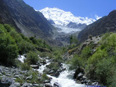
About 240 kilometers long the picturesque Neelum Valley is situated to the North & North East of Muzaffarabad. Running parallel to the Kaghan Valley. It is separated from it by snow covered peaks, some over 4000 meters above sea level. Excellent scenic beauty, panoramic view, towering hills on both sides of the noisy Neelum river, lush green forests, enchanting streams, high altitude lakes and attractive surroundings make the valley a dream come true. The swaying lush green forests, snow capped mountains, streams singing songs of joy, and fast flowing river Neelum, all go together to make it naturalist’s wonderland.The area is also ideal for mountain tourism. A part of Nanga Parbat Massif falls in this area which is dominated by "Sarwaali Peak" (6326 meters) the highest mountain in Azad Kashmir. Moreover like Kaghan Valley it is famous for fishing and angling activities in Neelum river and Jagran nullah which are stocked with trout fish. 
Traveling during May to October from the scorching heat of plains to the high land basin of Neelum Valley is indeed an escape from hell inferno to the cold breezes of paradise. The temperature remains in between 65°F to 90° F during the summer. The upper portion of the area normally receives first snow fall in the month of October and at some times even during September.
It is a valley of fountains, springs, waterfalls, flowering trees and plants. Geographically too, it is a hospitable valley. The Neelum Valley, 90 miles long bow-shaped with majestic pine, fir and deodar trees, lies north-south of Muzaffarabad (capital). This ninety-mile long kingdom of vegetation is ripped apart by the indigo blue Neelum river which flows serpentinely down hills to merge itself into the river Jhelum at Domail. Domail, the confluence of two mighty rivers, presents highly fascinating scene of youthful embrace. This heart-warning spectacle is most soothing to the eye.
The valley, starting from Muzaffarabad, the capital of Azad Kashmir, is about 150 miles long. It lies on both sides of the river Neelum. The geographical features enhance the natural beauty of the Valley. Its elevation, a mere 2,000 feet at the start, gradually rises till it attains a respectable height of 8,000 feet. On both sides there are high mountains and peaks. Nearly all the forest wealth of Azad Kashmir is to be found in this part of the State.

How to Get There:
There are two approaches to the valley. One from the Kaghan Valley which is linked with it at two points, the Nuri Nari Hali (Pass) and the Ratti Gali and many minor Passes. From Dawarian it takes two days for hiking or riding and night stay at Dharian at 12,000 feet. The second approach is from Muzaffarabad. It is a distance of 55 miles which is jeepable in fair weather. On a number of places, the local population has built rope crossings on the river. It is a very dangerous drive and the very thought of crossing these points is horrible but thrilling.
The area is well connected by road, more than half of it from Muzaffarabad is black topped, while remaining is all weather (un metalled), which is being metalled. A regular bus service up to Kel is available. However you can drive in your own car up to Dowarian from there onwards you have to switch over to Jeeps for your drive.

Places To Visit:

Pattheka: The valley is accessible by an all weather road metalled up to Kundal Shahi and well maintained up to Kel. At the gateway to the Valley lies a sprawling town of Pattheka with a dependable commercial centre. For a tourist, Pattheka can be the first journey break. This town has a modest bazaar with day-to-day activity. All essential items are available in the bazaar which feeds a fairly large number of villages behind it. On its back runs the forth-emitting river Neelum. The village and bazaar are connected by a suspension bridge crossable by jeep alone. The running streams, water channels and water falls across the Pattheka village present another heart winning scene. It is fully electrified.  The quality of life here is full of emotions despite its simplicity. The serene atmosphere shrouded into lush greenery and milky-white waterfalls and water curses and their rhythmic flow totally absorbs the visitors. Added to the general plant fragrance is the sweet smell of menthol plants along the banks of the nullah, it cuts its way across the crop-fields in such wavy manner that it looks as a white ribbons over green head of damsel Nature. Bhateeka is linked by ancillary roads with other surrounding areas uphill and downhill.

Kundal Shahi: It is the entrance of Jagran. Here Jagran Nullah converges into Neelum River. It is situated at a  distance of 74 Kilometers from Muzaffarabad and about 5 kilometers from Authmuqam. In Authmuqam and Kundal Shahi almost all basic necessities are available in the local market.
At a distance of 74 Km. from Muzaffarabad one can reach Kundal Shahi. From this place a visit can be planned to the loveliest part of the Neelum Valley, commonly known as Jagran Valley. 

Jagran: Nestled in the lower part of Neelum valley, the picturesque “Jagran” is its inseparable part. Jagran Nullah (stream) is indispensable and plays pivotal role in the formation of its landscape beauty and charm which reveals the richness of the area. On the side lane of the impressive Tourists Resort the ever flowing greenish and surf gushing  waters of Jagran Nullah add to its peculiar character. jagran Nullah, rushing downwards all along the tall grooves of trees is almost small river. Surrounded by scintillating beauty under the shades of the majestic snow-clad mountains the river is freezing cold. The snowmelt of these sky heights named “Jagran Nullah” is also know for trout fishing attracting angles all over the seasons.
In Jagran places like kutton, Thunian, Ghansee and Pattlian Sar are worth-seeing and inviting everyone to visit and enjoy. Jagran is ideal for mountaineers and trackers too. Gradual and fathering of uphill distance is encountered with the pleasant and soothing environment which never fades into memory.

Salkhala: Not more than 3 kilometers from Kundal Shahi across the river Neelum one can enjoy the lovely place Salkhala. A Trout hatchery has been established by the Azad Kashmir Fisheries Department. A reasonable accommodation facility is available here.

Kutton: Uphill road from Kundal Shahi leads to Kutton at a distance of 6 kilometers. The picturesque Kutton and Jagran is best to visit during April to October. Here the Greater Hydle Power is also an additional attraction for the tourists. The famous Nullah Jagran passes through this valley. At kutton about 8 kilometers from Kundal Shahi a hatchery for Trout fish is established by the fisheries department.
Athmuqam10 Kilometers from Kundal Shahi is the Sub-Divisional Head-quarter of the area. The bazaar consists of over a dozen shops with a post office and telephone call office. This place is suitable for the people interested in calm and quite atmosphere.

Neelum: Another 9 Km journey ahead of Athmaqam takes you to Neelum. It is situated on the right bank of river Neelum opposite to the Keran village (Indian occupied Kashmir). Neelum having an altitude of 1524 meters above sea level is very popular among tourists.

Dowarian: Dowarian  at a distance of 13 Km from Neelum at an altitude of 1615 meters is surrounded by mountains full of conifer trees. Over here a mule track up to Rattigali pass (about 30 Km) towards west, connects the Neelum and Kaghan Valley.
Kairan: So far is the half of the Neelum Valley and after it are the more enchanting spots full of exuberance and life. Kairan is another beauty spot on the river side with a neat and clean wooden flooring rest house. Its lawns slope down towards the western bank of the river.  Commodities are transported to the bazaar from Athmaqam by trucks. The physical feature of Kairan resort resembles a broad forehead of a person with thick hair on the head. Stay is more comfortable here.

Sharda: The most picturesque place in Neelum Valley is “ Sharda” it is located at a distance  of 136 Km from Muzaffarabad and 30 Km from Dowarian. It is a breath taking spot. This place from the point of view of tourists is so attractive and captivating that they get their money’s worth when they spend a few days here in their sojourn amidst nature. In Sharda one also finds ruins of an old place of learning. The presence of these ruins lends Sharda is a historical background providing special attraction for the people interested in archaeology and history.

Kel: 19 kilometers journey from Sharda, upstream takes one to Kel. It is a small valley at the height of 2097 meters. This is another picturesque place in the Neelum Valley . The Shounter Nullah joins river Neelum at this place and leads to Gilgit Agency over the Shounter Pass (4,420 meter). Kel is also  a base camp of mountaineering  activities up to “ Sarawaal peak” 6326 meters above sea level and “Sarawaali Glacier”  which are said to be the highest peak and biggest glacier of Azad Kashmir.

Halmet: The border village about 38 km ahead of Kel, is a fascination yet unexplored. Janawai, and Sardari are the most beautiful places around here. A tourist rest house had been constructed a Halmat to provide accommodation facilities to the visitors.

Tao Butt: It is an example of vegetation generosity of the liberal nature. The spot is donned with all delicacies and niceties. Nature flirts here with fantastic environment. 

(Note) :   Some of the tourist places of Neelum Valley are situated in the range of Line of Control, therefore sometimes it become difficult to visit these areas. So before visiting the valley, the visitors are required to get information.

Activities:

Fishing: The water snow fed  river and streams are ideal for trout. Some time back this fish was introduced in the Valley . Trout spawn naturally in Neelum river and hatcheries have been developed at Salkhala, Kutton and Dowarian to restock depleted water.
Trekking Neelum Valley provides a variety of treks at varying altitudes durations, ranging from a day to a week via from Dowarian or Sharda to Ratti Gali with duration of 3 days, reaching a maximum altitude of 4140 meters and the trek can be extended to the Kagan Valley by crossing the Ratti Gali Pass. Near the pass one can see an ideal natural lake “ Ratti Gali Sar” at an altitude of 3832 meters. A challenging trek of a week’s duration is from kel to Astor via Shounter Gali, reaching a maximum altitude of 4260 meters. It is also a regular route for trade between Kel and Astore.


GILGIT VALLEY

 
At an elevation of 1,454 metres lies the Gilgit Valley. The quaint little town of Gilgit has spectacular scenic beauty. The peak tourist season is from April to October though you can visit the valley round the year. The maximum temperature in May is 33 C and the minimum 16 C and in September, maximum 28 C and minimum 11 C.

FAMOUS POINTS: 

Gilgit Bridge: The bridge over the fast flowing Gilgit River, at the end of its traditional bazaar, is the largest suspension bridge in Asia (182 metres long and 2 metres wide) permitting enough room for one jeep at a time to cross.

Kargah Buddha: Located on a rock near Kargah Nullah (ravine), 10 km. from Gilgit town is a beautiful rock engraving of Buddha from 7th century A.D.

Monument of Taj Mughal: A victory monument of Taj Mughal, built 700 years ago, is 30 km. jeep drive from Gilgit town.

Sher Qilla: It is 38 km. from Gilgit - Trekking route links with Naltar valley. Trout fishing can be enjoyed in Sher Qilla Nullah and a small lake.

Singal: About 61 km from Gilgit - Trekking route links with Chilas and Kohistan valley.

Gahkuch: Headquarter of Ghizer District - Ideal place for trekking, good fishing sports and duck shooting in season. It is the gateway to Iskoman Valley. Government rest house and private hotels are available (73 km from Gilgit). Archaeological sites in village and a near by village Hatoon.

Naltar Valley: Two hours jeep drive from Gilgit link rod. Government Rest house, Private hotels and a Ski slope, lush green Alpine forest with small lakes and glaciers, trout fishing in lake. Trekking routes link with Iskoman, Chalt and Punial valley.


HOW TO REACH:


BY Air: PIA operates three daily flights between Islamabad and Gilgit. All flights are subject to good weather. The flying time is one hour and one-way fare is approximately US $ 44 for foreigners.

By Road: Gilgit is also accessible from Islamabad/Rawalpindi by the Karakoram Highway. Rawalpindi to Gilgit via Swat is 704 km and takes 19 hours by bus/van; Rawalpindi to Gilgit via Thakot: 628 km. 16 hours by bus/van; Rawalpindi to Gilgit via Babusar Pass 535 km. 21 hours by jeep.

There is a regular bus and van services operate on the Karakoram Highway between Rawalpindi and Gilgit via Besham. The main bus terminal of NATCO & other private bus lines is at Pirwadhai General Bus Stand, Rawalpindi. Advance booking is required (Tel: 051-5462181)


Monday, August 15, 2011

SKARDU


Skardu, capital of Baltistan is perched 2,438 metres above sea level in the backdrop of the great peaks of the Karakorams. Balti people are a mixture of Tibetan and Caucasian stock and speak Balti, an ancient form of Tibetan. Due to the similarity of its culture, lifestyle and architecture with Tibet, Baltistan is also known as the "Tibet-e-Khurd" (Little Tibet). It borders on the Chinese province of Xinjiang and Indian-occupied Kashmir. The tourist season is from April to October. The maximum temperature is 27 C and minimum (October) 8 C. Apart from its incomparable cluster of mountain peaks and glaciers Baltistan's five valleys - Shigar, Skardu, Khaplu, Rondu and Kharmang are noted for their luscious peaches, apricots, apples and pears.


Skardu is linked to the national capital, Islamabad by PIA, which operates one flight daily. The air journey is full of thrills and would itself be regarded as the highlight of the visit. After following the same air route, which connects Gilgit to Islamabad/Rawalpindi, the plane turns right and flies over the gorge of the Indus River. Enormous rock faces rise on either side or at times it seems as if the wing tips of the plane would almost scrape against them. They never do.

Baltistan is known as the "Tibet-e-Khurd", or Little Tibet since its life-style reflects that of the Roof of the World and the Land of Lamas.It borders on the Chinese province of Xinjiang and Indian-occupied Kashmir.

The tourist season is from April to October. The maximum temperature is 27 C and minimum (October) 8 C.  Apart from its incomparable cluster of mountain peaks and glaciers Baltistan's five valleys, - Shigar, Skardu, Khaplu, Rondu and Kharmang are noted for their luscious peaches, apricots, apples and pears.